Monday
Jul112011
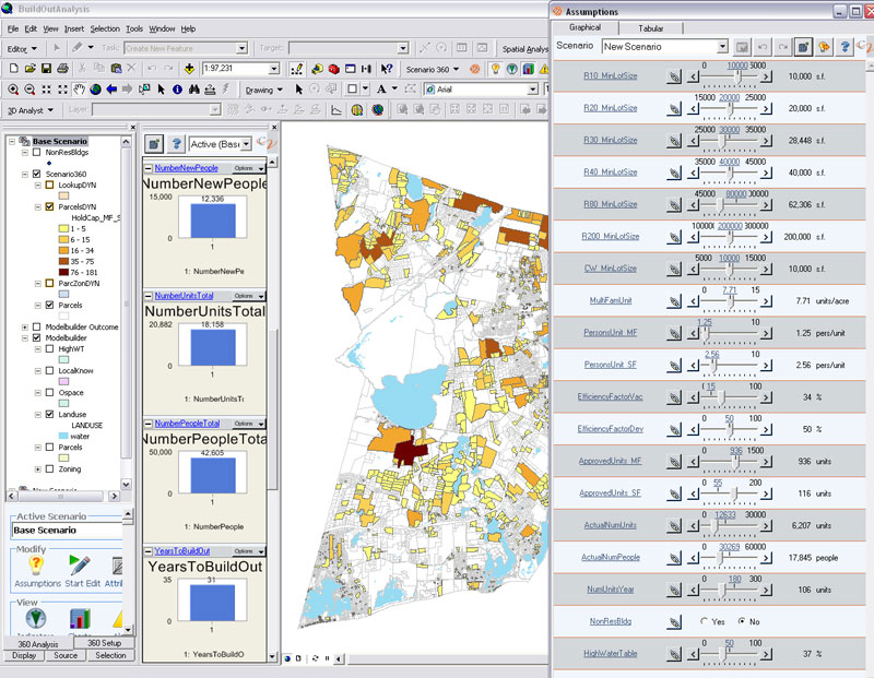
CommunityViz™
CommunityViz™ is the first complete, multi-dimensional Planning Decision Support Systems Systems to be released commercially.

CommunityViz™ is the first complete, multi-dimensional Planning Decision Support Systems Systems to be released commercially.
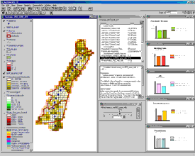
Under a grant from the Transportation and Community and System Preservation (TCSP), the City of Houston engaged the ESC to develop a land development model and performance tracking system to monitor growth along the City's Main Street Corridor. The goals of the system were threefold: 1) provide a system that measures the performance of the corridor with regards to community goals and values; 2) track change as it occurs, and 3) allocate future-year growth to where it is likely to occur. The system, dubbed the Performance/ Tracking/Allocation (P/T/A) system, consists of two parts: the P/T/A Land Development Model and the P/T/A Performance Report Card.
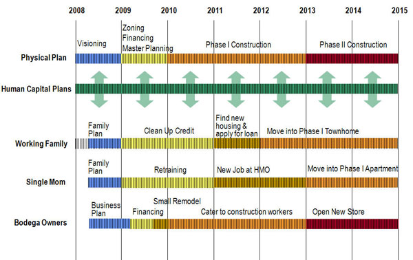 The Environmental Simulation Center (ESC) received a three-year grant from the Ford Foundation to develop the Human Development Overlay District (HD-ODTM). This initiative will harness emerging information technologies to connect the often fragmented social service and physical planning processes in neighborhoods undergoing rapid change due to catalytic development projects.