
Houston - Performance, Tracking, and Allocation
Under a grant from the Transportation and Community and System Preservation (TCSP), the City of Houston engaged the ESC to develop a land development model and performance tracking system to monitor growth along the City's Main Street Corridor. The goals of the system were threefold: 1) provide a system that measures the performance of the corridor with regards to community goals and values; 2) track change as it occurs, and 3) allocate future-year growth to where it is likely to occur. The system, dubbed the Performance/ Tracking/Allocation (P/T/A) system, consists of two parts: the P/T/A Land Development Model and the P/T/A Performance Report Card.
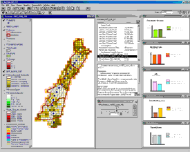
The P/T/A Land Development Model produces current month population, housing unit, household and employment estimates for grid cells that represent 1000 feet square. It produces these estimates by using information already collected by the City in its issuances of building permits .The Model allocates expected future year growth to these same grid cells by calculating the development suitability of land for various land uses. The Model also tracks changes related to 43 separate variables, which correspond to 22 over-arching indicators that can be used to measure the performance of the corridor. The ESC developed the P/T/A Land Development Model using the Scenario Constructor component of CommunityViz, therefore all formulas and assumptions are completely transparent and adjustable by the user.
The Model is linked to the P/T/A Performance Report Card, which organizes and evaluates all 22 indicators against the City's goals and objectives. Goals and Objectives can be weighted against each other in terms of their importance to the community; therefore "performance" is value-based. In addition, the interface allows the user to evaluate performance at multiple levels of geography – the entire corridor, any specific district, or any light-rail station area.
The P/T/A system was used to evaluate the results the regional planning agency's UrbanSim regional forecast and help identify areas for improvement in those forecasts.
 View Printer Friendly Version